


Bathymetry
Bathymetry is a field of science dealing with measuring depths of lakes, rivers and seas. On the basis of measurements performed, the maps of water reservoir beds or cross-sections of river beds are made.
On the basis of this type of studies, the manager of a given watercourse or reservoir is able to determine:
- which fragment requires deepening or alignment,
- places safe or dangerous for swimming,
- navigation routes,
- water capacity of a reservoir
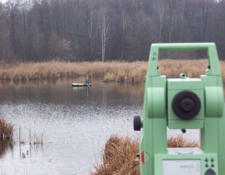
Measurements of the depth of waterbed, depending on the size and depth are made by means of coupled geodetic devices, such as electronic total station or GPS, or hydrological measurements, e.g.: sonar points, sonars.
The end product of bathymetric measurements could be:
- bathymetric maps in the form of bottom contours – contour lines connecting points with the same depth
- Digital Terrain Model of the reservoir waterbed
- longitudinal and cross-section of watercourses
We have our own boats and also we cooperate with the captains of several ships in the case of large reservoirs. The works are carried out by experienced teams. We also have experience in cooperation with other teams of divers, engineers, thanks to which we help other businesses in the realisation of engineering works on rivers and lakes.